Habitat Restoration Across the Klinse-Za Caribou Herd Range
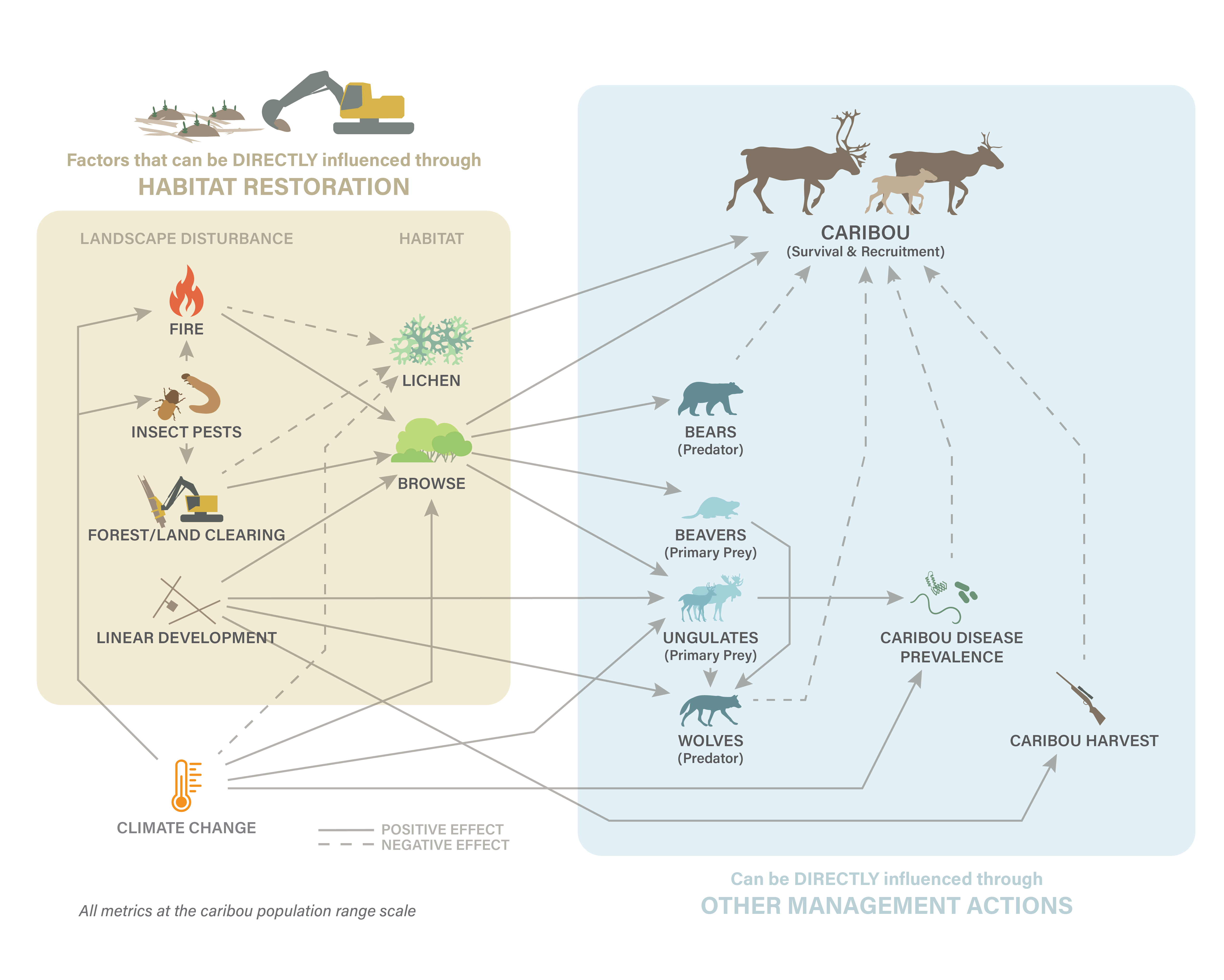
The Klinse-Za herd area, located between Mackenzie, Chetwynd and the Peace Arm of Williston reservoir, used to support a herd of almost 200 caribou as recently as 1995 and was said to be so numerous in historic times as be “like bugs on the land”. However, the herd has declined to under 40 individuals by 2013. Across BC, many caribou herds have experienced the same steep declines, and most of the struggling herds are inhabiting areas with generally more human disturbance and activity on the landscape. Specifically, industrial development has contributed to caribou declines as their habitat has been altered, displacing the caribou and making them more susceptible to predation. Since 2013, costly and intensive management efforts including maternity penning and predator removal have helped halt or reduce the rate of decline in some herds. However, these activities are not going to keep caribou on the land base over the long term. To improve caribou habitat, support the ecosystem and balance the predator-prey dynamics, we are implementing a large-scale habitat restoration project in the Klinse-za caribou herd area.
Restoration of habitat can involve a variety of activities. In the Klinse-za habitat restoration program, we focus our efforts on reforesting and restructuring linear features (e.g., old roads, seismic lines). This will limit the ability of predators to easily access caribou habitat and minimize caribou- predator interactions. Over time, reforesting the features will return the ecosystem to a more natural state.
See this (gorgeous) short film for more informaiton: Caribou Homeland