Search Results
Displaying:
1 - 4 of 4
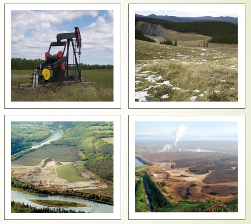
High-resolution Satellite Imagery Applied to Monitoring Revegetation of Oil-sands-exploration Well Pads
Resource
Project demonstrated that high-spatial-resolution satellite imagery could be used to develop accurate land-cover classifications on reclaimed in-situ operations

The Genetic and Economic Gains from Forest Tree Breeding Programmes in Scandinavia and Finland
Resource
This resource is available on an external database and may require a paid subscription to access it. It is included on the CCLM to support our goal of capturing and sharing the breadth of all...
Towards a Shared Foundation for Innovation and Evolution
Resource
At the 2023 Alberta Chapter, Canadian Land Reclamation Association annual conference, Chris Powter, Tanya Richens, Andy Etmanski, Amanda Schoonmaker, and Dean MacKenzie participated in a panel...