
Search Results
Displaying:
1 - 20 of 243
A Field Guide to the Wetlands of the Boreal Plains Ecozone of Canada
Resource
This guide provides an in-depth look at Ducks Unlimited Canada's (DUC) remote-sensing satellite mapping efforts and the development of the DUC enhanced wetland classification system.

Alberta Wetland Classification System Field Guide
Resource
The Alberta Wetland Classification System Field Guide is a visual, plain-language field guide for identifying and classifying wetlands based on the Alberta Wetland Classification System (AWCS). The...

April 2024 Wetland Knowledge Exchange Webinar - Recording
Resource
Boreal peatland restoration through partial removal of an oil and gas well pad Murdoch McKinnon, University of Waterloo Peatlands cover over 30% of the landscape on Canada’s Western Boreal Plains...

Boreal Caribou Survival in a Warming Climate, Labrador, Canada 1996–2014
Resource
Highlights Boreal caribou persistence has been affected by landscape disturbance and subsequent apparent competition. Climatic conditions also affect caribou via energy gains and losses and indirectly...

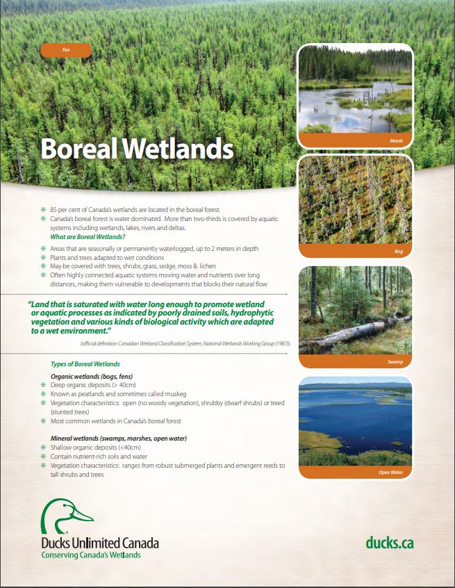
Boreal Wetland Factsheets
Resource
These fact sheets highlight plant, soil, and water indicators and key ecological benefits of each of the five major wetlands types.
Boreal Wetlands and Waterfowl: A Commitment to Stewardship Activities in Manitoba
Resource
Ducks Unlimited Canada (DUC) initiated the Western Boreal Program in 1997 with an understanding that working with forward thinking forest industry partners was key to advancing wetland conservation in...

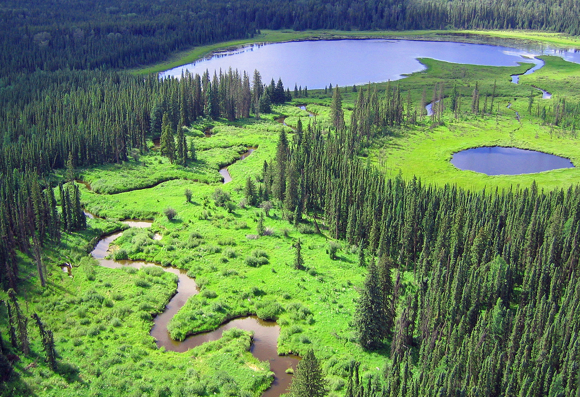
Boreal Wetlands of Canada and the United States of America
Resource
The Canadian and Alaskan boreal zone is one of the most water rich areas in the world, and contains an estimated combined surface water and peatland area the size of Indonesia (∼1.94 million km2)...
Building Better Crossings: Incorporating Wetland Knowledge into Road Planning and Construction
Resource
This research poster gives an overview of the relationship between roads and wetland flow, discusses tips and tools for planning and outlines a case study of developed crossings. Presented at the NAIT...

Canadian Fieldwork Applications
Resource
Did you know that you can learn to identify and report invasive species, measure trees, and become a citizen scientist all at the touch of your smartphone? Check out this list of free, Canadian field...

Canadian Wetland Inventory using Google Earth Engine: The First Map and Preliminary Results
Resource
Although wetlands provide valuable services to humans and the environment and cover a large portion of Canada, there is currently no Canada-wide wetland inventory based on the specifications defined...

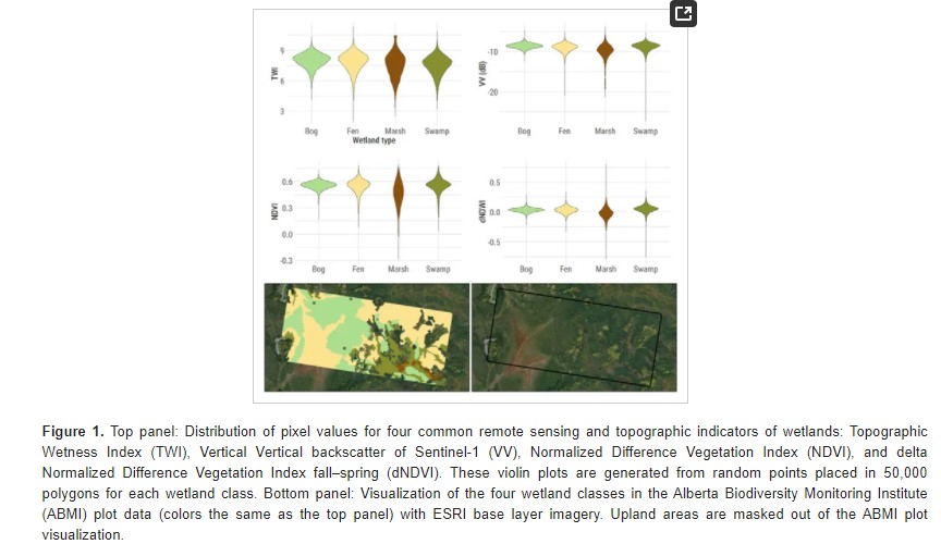
Comparing Deep Learning and Shallow Learning for Large-Scale Wetland Classification in Alberta, Canada
Resource
Developed two wetland inventory style products for a large (397,958 km2) area in the Boreal Forest region of Alberta, Canada, using Sentinel-1, Sentinel-2, and ALOS DEM data
Context-dependent Group Size: Effects of Population Density, Habitat, and Season
Resource
Group size can vary in relation to population density, habitat, and season. Habitat and season may also interact with population density and affect group size through varying foraging benefits of...
Coyote (Canis latrans) Diet and Spatial Co-occurrence with Woodland Caribou (Rangifer tarandus caribou)
Resource
The interplay of predator encounters and antipredator responses is an integral part of understanding predator–prey interactions and spatial co-occurrence and avoidance can elucidate these interactions...
Creating a Detailed Wetland Inventory with Sentinel-2 Time-Series Data and Google Earth Engine in the Prairie Pothole Region of Canada
Resource
Wetlands in the Prairie Pothole Region (PPR) of Canada and the United States represent a unique mapping challenge. They are dynamic both seasonally and year-to-year, are very small, and frequently...
