
Search Results
Displaying:
1 - 20 of 26
Action Plan for the Bluenose-East Caribou Herd
Resource
A 56-page action plan for the Bluenose-east herd prepared by the wildlife management boards with stewardship responsibilities for barren-ground caribou and their habitat in the Northwest Territories...

Biogeochemical Response to Vegetation and Hydrologic Change in an Alaskan Boreal Fen Ecosystem
Resource
Boreal peatlands store approximately one third of the earth’s terrestrial carbon, locked away in currently waterlogged and frozen conditions. Peatlands of boreal and arctic ecosystems are affected...

COSIA In-Situ Oil Sands Shared Practices for Working in and Around Wetlands
Resource
This report compiles a toolbox of shared practices currently in use by COSIA companies, or which have been used but were found to be unsuccessful.

Decision-support Tools to Assess Cumulative Effects on the Cape Bathurst, Tuktoyaktuk Peninsula, Bluenose-West, and Bluenose-East Herds of Barren-ground Caribou – Project Summary Report
Resource
This report summarizes a project whose purpose was to collaboratively develop decision-support tools that will help northern decision-makers review, explore, and learn about the cumulative effects of...

Does Dust from Arctic Mines Affect Caribou Forage?
Resource
A 2017 paper assessing the impacts of dust from a mining haul road in the NWT on vegetation used by caribou. The paper concluded that dust from the road negatively affected the vegetation within a...

Joint Management Proposals for: Sahtì (Bluenose-East) Ekwǫ̀ Herd, and Kǫk’èetı (Bathurst) Ekwǫ̀ Herd
News
Following a calving ground survey last June and a composition survey last October, the population for Sahtì Ekwǫ̀ is estimated to be 23,200 animals – about 4,000 more than in 2018. However, this total...
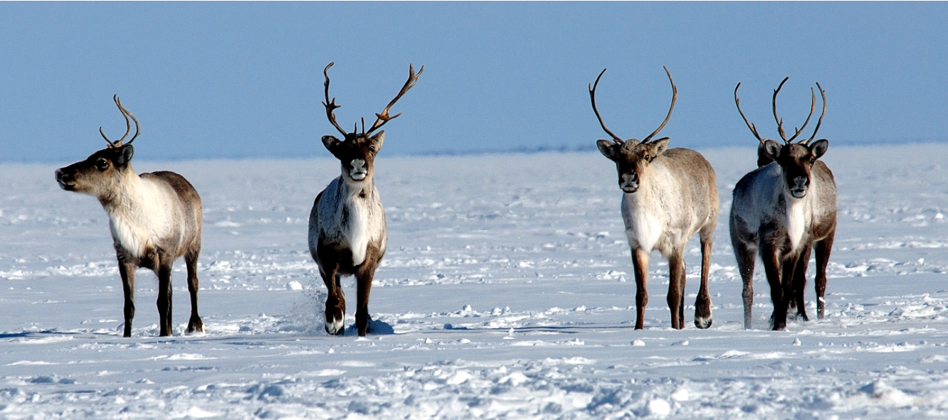
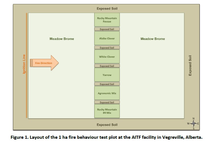
Less Flammable Vegetation for Linear Industry Rights-‐of-‐way
Resource
FPInnovations launched a multi-year study to determine whether a less-flammable, herbaceous species could replace the flammable grasses that typically colonize linear ROWs
Northern Caribou Canada
Project
Contact
Organization:
About the Northern Caribou Canada: Who This is a project of the Wekʼèezhìi Renewable Resources Board in collaboration with the organizations, governments, and agencies listed on the bottom of the page...

Peat Loss Collocates with a Threshold in Plant–Mycorrhizal Associations in Drained Peatlands Encroached by Trees
Resource
Drainage-induced encroachment by trees may have major effects on the carbon balance of northern peatlands, and responses of microbial communities are likely to play a central mechanistic role. We...

Reasons for Decision Final Report, Part B - Bluenose-East Caribou Herd
Resource
Serious conservation concern exists for the Bluenose-East caribou herd and additional management actions are vital for herd recovery. The first report, Part A, dealt with the proposed harvest...
Reasons for Decisions Related to a Joint Proposal for Dìga (Wolf) Management in Wek’èezhìı
Resource
A 109-page document on the reasons for decision of the Wek’èezhìı Renewable Resources Board regarding wolf management in the region.
Resource Roads and Wetlands: A Guide for Planning, Construction, and Maintenance
Resource
This guide contains best management practices that help plan, construct and maintain resource roads in forested environments in order to maintain the movement of water in wetlands.

Resource Roads and Wetlands: Practical Applications to Maintain Hydrologic Connectivity
Resource
This presentation highlights planning and operations applications of water management techniques for resource roads crossing wetlands.

The Effects of Black Spruce Fuel Management on Surface Fuel Condition and Peat Burn Severity in an Experimental Fire
Resource
This resource is available on an external database and may require a paid subscription to access it. It is included on the CCLM to support our goal of capturing and sharing the breadth of all...
The Third Generation of Pan-Canadian Wetland Map at 10 m Resolution Using Multisource Earth Observation Data on Cloud Computing Platform
Resource
Development of the Canadian Wetland Inventory Map (CWIM) has thus far proceeded over two generations, reporting the extent and location of bog, fen, swamp, marsh, and water wetlands across the country...