
Search Results
Displaying:
281 - 300 of 520
Plain Language Explanation of Human Health Risk Assessment
Resource
Key determinants of people’s exposure to chemical pollutants are: time-activity (where we spend time and what we do), interaction with indoor environments, diet, and occupation

Plant Functional Traits as Indicator of the Ecological Condition of Wetlands in the Grassland and Parkland of Alberta, Canada
Resource
The analysis of functional trait-habitat relationships has been used to measure the degree to which environmental factors influence the assembly of ecological communities. In the Parkland and...

Plow-in Pipeline Construction Improves Recovery of Rough Fescue Grassland
Resource
Plow-in pipeline approach resulted in a fescue-bluegrass vegetation community that had the best rough fescue recovery and greatest similarity to undisturbed natural grassland

Potential of Macrophytes for Wastewater Remediation with Constructed Floating Wetlands in Cold Climates
Resource
Nature-based, low technology wastewater treatment systems can benefit small and remote communities. Adding a constructed floating wetland (CFW) to waste stabilization ponds can enhance treatment...
Potential Spatial Overlap of Heritage Sites and Protected Areas in a Boreal Region of Northern Canada
Project
Organization:
This project examined the potential overlap between Gwich'in First Nations (Northwest Territories, Canada) heritage sites and areas independently identified for the protection of conventional...

Potential Spatial Overlap of Heritage Sites and Protected Areas in a Boreal Region of Northern Canada
Resource
Abstract Under article 8-J of the Convention on Biological Diversity, governments must engage indigenous and local communities in the designation and management of protected areas. A better...

Predicting Invasive Plant Response to Climate Change: Prioritization and Mapping of New Potential Threats to Alberta’s Biodiversity
Resource
Assessed 16 potentially new invasive plant species not yet present in Alberta for their invasiveness and climate change-related risk

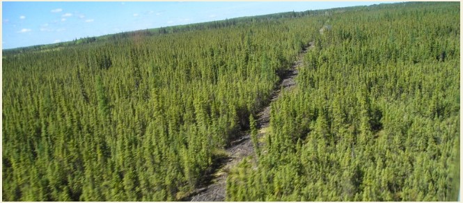
Predicting Patterns of Regeneration on Seismic Lines to Inform Restoration Planning in Boreal Forest Habitats
Resource
Mapping of oil reserves involves the use of seismic lines (linear disturbances) to determine size of reserves. These linear disturbances fragment forests and in many cases fail to regenerate trees...
Predicting the Cumulative Effects of Human Development on Biodiversity in Northeastern Alberta
Resource
We used information from the Alberta Biodiversity Monitoring Institute (ABMI) on birds, plants, human footprint, and vegetation, plus information from Dr. Bayne on birds, to test a new method for...

Preliminary Watershed Hydrology Model for Reclaimed Oil Sands Sites
Resource
Modelling results for the regional watersheds were encouraging and demonstrate that SWATBF has the potential to be utilized as a practical tool for conducting hydrologic assessments in the oil sands

Press Release: Agreement Between Pulse Seismic and the ABMI Benefits Research on Seismic Line Recovery in Alberta
News
Organization
Pulse Seismic Inc. (Pulse) and the Alberta Biodiversity Monitoring Institute (ABMI) have signed a data sharing agreement to enhance public information on seismic lines in Alberta.
Prioritization can Improve Cost Effectiveness of Seismic Line Restoration
Resource
Upland mesic sites showed a relatively strong ability to regenerate on their own (passive restoration), while lowland (bogs and fens) and upland dry sites were slow to recover.

Prioritizing Zones for Caribou Habitat Restoration in the Canada's Oil Sands Innovation Alliance Area V1.0
Resource
Boreal caribou populations are declining across Alberta and much of their Canadian range. Key factors causing this decline include a warming climate along with habitat change from industrial...

Prioritizing Zones for Caribou Habitat Restoration in the Canada's Oil Sands Innovation Alliance Area V2.0
Resource
Seismic lines and other linear features created by humans are thought to negatively impact woodland caribou. It is estimated that there are c. 100,000 km of conventional seismic lines in caribou...

Prioritizing Zones for Caribou Habitat Restoration in the Canada's Oil Sands Innovation Alliance Area V3.0
Resource
Linear features, including seismic lines, pipelines, transmission lines, roads, railways, and trails are pervasive in Alberta’s boreal forest and have been implicated as a primary factor leading to...

Prioritizing Zones for Caribou Habitat Restoration in the Canada's Oil Sands Innovation Alliance (COSIA) Area V4.0
Resource
Seismic lines and other linear features (roads, railways, trails, transmission lines, pipelines, etc.) are pervasive in Alberta’s boreal forest. It is estimated that there are approximately 100,000 km...

Progress Report for 1982: Pinus banksiana-dominated Permanent Plots in the Athabasca Oil Sands
Resource
Of the 16 permanent plots established in 1981, four of these, Nos. 1,6,11, and 13 were destroyed by fire shortly after they were surveyed. In 1982, four new plots were established to replace the...

Projected Responses of Alberta Grassland Songbirds to Climate Change
Resource
Climate suitability projections, and current distribution of grassland and cropland habitats in Alberta suggest that some climate-mediated range expansion of grassland songbirds is possible

Proposed Design for a Program of Toxicological Research for the Alberta Oil Sands Environmental Research Program
Resource
A Toxicological Index is proposed to outline the toxicological significance of specific inorganic elements to mammals and aquatic organisms. Index provides a list of elements of environmental concern
