Search Results
Displaying:
1 - 20 of 23
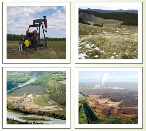
Certification of Mineral Soil Pads in the Boreal Region – Decision Framework and Support Tools: 2023 Update
Resource
This 2022 Update is a revision of the original Decision Framework and Support Tools report based on stakeholder feedback and a field verification trial.

Certification Of Mineral Soil Pads in The Boreal Region – Decision Framework and Support Tools: Stakeholder Review and Field Verification
Resource
Results of a stakeholder review of the draft Certification of Mineral Soil Pads in the Boreal Region – Decision Framework and Support Tools report and a field verification trial by practitioners.

Constructing Habitat for a Sustainable Native Fisheries in the Sphinx Lake End Pit Lake System
Resource
Pit reclaimed such that the end pit and inlet/outlet streams would sustain in perpetuity the full range of habitat and watershed features needed to support native Athabasca Rainbow and Bull Trout

Continental Synchrony and Local Responses: Climatic Effects on Spatiotemporal Patterns of Calving in a Social Ungulate
Resource
Warming temperatures and advancing spring are affecting annual snow and ice cycles, as well as plant phenology, across the Arctic and boreal regions. These changes may be linked to observed population...

Defining Best Management Practices for Conservation of Reclamation Materials in the Mineable Oil Sands Region of Alberta
Resource
Task-group formed to define Best Management Practices (BMPs) for conservation of reclamation materials in the mineable oil sands region of Alberta; easier to define BMPs for salvage than replacement

Factors Contributing to the Cultural and Spatial Variability of Landscape Burning by Native Peoples of Interior Alaska
Resource
This article analyzes the geographical extent to which native peoples of Interior Alaska used fire to modify the landscape at the time of European contact. Although wildfire has been central to the...
Factors that Result in Sustainable Forest Ecosystem Development on Padded Sites in Peatlands: Pilot Study
Resource
The pilot study validated the research questions, sampling design, measurement and data analysis methods developed for a large‐scale study, with some minor amendments.

Guide to Variance Justifications for Reclamation Certification of Wellsites and Associated Facilities: Stakeholder Review and Field Verification
Resource
Practitioners tested the Guide to Variance Justifications on four of those sites; three had been previously approved and one had been submitted and was pending a decision.

Identification and Characterization of Abandoned Padded Wellsites Using Remote Sensing
Resource
In 2018, the Petroleum Technology Alliance of Canada (PTAC) initiated a multi-stage project on the reclamation certification process for sites that were constructed using imported mineral soil pads in...

Integrating Coastal Vulnerability and Community-Based Subsistence Resource Mapping in Northwest Alaska
Resource
This resource is available on an external database and may require a paid subscription to access it. It is included on the CCLM to support our goal of capturing and sharing the breadth of all...
Land-use Planning Following Resource Extraction – Lessons from Grizzly Bears at Reclaimed and Active Open Pit Mines
Resource
Following closure, access management on designated trails will reduce risk of conflicts. Imposing access restrictions, preserving undisturbed habitat patches and restoring original vegetation

Life of Coal Mine Planning – Engaging in Land Use Planning at Luscar and Gregg River Mines
Resource
The Luscar and Gregg River Mines Land Management Plan Working Group was formed to develop a land management plan. The process engaged stakeholders representing a variety of community interests

Microtopography Matters: Belowground CH4 Cycling Regulated by Differing Microbial Processes in Peatland Hummocks and Lawns
Resource
This resource is available on an external database and may require a paid subscription to access it. It is included on the CCLM to support our goal of capturing and sharing the breadth of all...

Preparing Variance Justifications for Reclamation Certification of Wellsites and Associated Facilities on Forested Land: 2023 Update
Resource
In 2021, PTAC sought verification of the Guide to Preparing Variance Justifications and stakeholders were asked to apply the document to current sites in their work portfolio.

Revegetation of Post-mined Land Using Directly Planted Native and Local Shrub Species
Resource
Hand collecting vegetative propagules from surrounding pre-mined land and directly planting these propagules on post-mined land may be the only method to successfully establish key shrub species

Soil Salvage and Placement – Breaking New Ground at Teck’s Cheviot Open Pit Coal Mine
Resource
Reclamation objectives include forest establishment, watershed protection, wildlife habitat, biodiversity and recreational use, and soil management practices determine in large part the success

Surface Soil Handling on Mines in the Boreal Forest – from Textbook to Operations
Resource
Research has shown forest surface soil provides an economical, diverse and abundant source of native propagules and an important source of nutrients and soil fauna. Salvage depth affects soil quality

The Third Generation of Pan-Canadian Wetland Map at 10 m Resolution Using Multisource Earth Observation Data on Cloud Computing Platform
Resource
Development of the Canadian Wetland Inventory Map (CWIM) has thus far proceeded over two generations, reporting the extent and location of bog, fen, swamp, marsh, and water wetlands across the country...

Towards a Shared Foundation for Innovation and Evolution
Resource
At the 2023 Alberta Chapter, Canadian Land Reclamation Association annual conference, Chris Powter, Tanya Richens, Andy Etmanski, Amanda Schoonmaker, and Dean MacKenzie participated in a panel...