
Search Results
Displaying:
141 - 160 of 311
Transportation Corridor Study. Volume 4 Appendix: Environment - General Characteristics & Conditions - Part 1
Resource
Contains the following sections: Environment Characteristics and Conditions; Soils; Wildlife; and, Preliminary Review and Land Evaluation

Transportation Corridor Study. Volume 4 Appendix: Environment - General Characteristics & Conditions - Part 2
Resource
Contains the following chapters: Environment Characteristics and Conditions; Soils; Wildlife; and Human Settlement Pattern of the Expanded Study Area

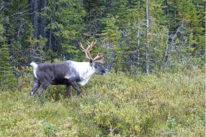
Trophic Consequences of Terrestrial Eutrophication for a Threatened Ungulate
Resource
Conservation actions directed at the proximate cause of caribou decline have been more successful in the near term than those directed further along the trophic chain.
"Two-Eyed Seeing": An Indigenous Framework to Transform Fisheries Research and Management
Resource
Increasingly, fisheries researchers and managers seek or are compelled to “bridge” Indigenous knowledge systems with Western scientific approaches to understanding and governing fisheries. Here, we...

Using Perceptions as Evidence to Improve Conservation and Environmental Management
Resource
The conservation community is increasingly focusing on the monitoring and evaluation of management, governance, ecological, and social considerations as part of a broader move toward adaptive...
Video - 2016 Wetland Best Management Practices Workshop: Opening Remarks
Resource
With over 75 years of experience and activity in every province and territory, Ducks Unlimited Canada (DUC) is a registered charity and a recognized leader in wetland conservation. DUC is a science...

Video - Applications of Wetland Inventories
Resource
The various applications of Ducks Unlimited Canada’s wetland inventories play a critical role in wetland conservation. They serve as key planning tools, helping people who live and work in the boreal...

Video - Assessment of forest attributes using airborne and terrestrial LiDAR
Resource
This presentation discusses the different ways that LiDAR data can be effectively used in forestry management applications.

Video - Boreal Wetlands Remote Sensing
Resource
In order to protect boreal wetlands, we must first know where they are. This 6-minute video will show you how Ducks Unlimited Canada uses satellite data and remote sensing techniques to map wetlands...

Video - Ecological Resiliency
Resource
This introductory lecture at the seminar on Resiliency of Reclaimed Boreal Forest Landscapes discusses the two sides of the coin, ecosystem resilience and engineering resilience.

Video - Incorporation of Wetlands into Forest Management
Resource
The Duck Mountain Provincial Forest in west-central Manitoba is a landbase with a mosaic of uplands and wetlands. The wetlands are both interspersed and interconnected with uplands. Ecosystem Based...

Video - Innovative Information Management to Support Wetland Conservation
Resource
This presentation provides an overview of the Ducks Unlimited Canada Best Management Practices (BMP) program and the road to and purpose of the 2016 Wetland BMP Workshop.

Video - The TRIA Project: Genomics of the Mountain Pine Beetle system
Resource
This presentation discusses the TRIA Project and it's use related to mountain pine beetle populations, physiological genomics and risk modeling.

Video - Too Much and Too Little Water, Adaptation Strategies for Municipalities
Resource
This presentation discusses explains how climate change and land use changes impact water supply and how we can adapt.

Video - Wetland Retention and Restoration: A Business Case for Conservation in the Settled Areas of Alberta
Resource
This presentation explains the economic case for wetland conservation in the White Zone of Alberta.

Video - Wetlands 101
Resource
This 10-minute video will equip you with the knowledge to identify the different wetland classes found in Canada's boreal. Identification of wetland types is a first step toward conservation and a...

Waste Dump Design for Erosion Control
Resource
Several foothills/mountain coal mine waste dumps were selected for the purpose of evaluating the effects of final configuration on the amount of surface erosion occurring on those dump surfaces

Weaving Indigenous Knowledge Systems and Western Sciences in Terrestrial Research, Monitoring and Management in Canada: A Protocol for a Systematic Map
Resource
Human activities and development have contributed to declines in biodiversity across the globe. Understanding and addressing biodiversity loss will require the mobilization of diverse knowledge...