
Search Results
Displaying:
1 - 20 of 248
A Field Guide to the Wetlands of the Boreal Plains Ecozone of Canada
Resource
This guide provides an in-depth look at Ducks Unlimited Canada's (DUC) remote-sensing satellite mapping efforts and the development of the DUC enhanced wetland classification system.

A Regional-Scale Index for Assessing the Exposure of Drinking-Water Sources to Wildfires
Resource
Recent human-interface wildfires around the world have raised concerns regarding the reliability of freshwater supply flowing from severely burned watersheds. Degraded source water quality can often...

A Synthesis of Three Decades of Eco-Hydrological Research at Scotty Creek, NWT, Canada
Resource
Scotty Creek, Northwest Territories (NWT), Canada, has been the focus of eco-hydrological research for nearly three decades. Over this period, field and modelling studies have generated new insights...
Alberta Wetland Classification System Field Guide
Resource
The Alberta Wetland Classification System Field Guide is a visual, plain-language field guide for identifying and classifying wetlands based on the Alberta Wetland Classification System (AWCS). The...

Applying Remote Sensing for Large-landscape Problems: Inventorying and Tracking Habitat Recovery for a Broadly Distributed Species At Risk
Resource
Abstract Anthropogenic habitat alteration is leading to the reduction of global biodiversity. Consequently, there is an imminent need to understand the state and trend of habitat alteration across...

Applying Remote Sensing for Large-landscape Problems: Inventorying and Tracking Habitat Recovery for a Broadly Distributed Species At Risk
Resource
Anthropogenic habitat alteration is leading to the reduction of global biodiversity. Consequently, there is an imminent need to understand the state and trend of habitat alteration across broad areas...

April 2024 Wetland Knowledge Exchange Webinar - Recording
Resource
Boreal peatland restoration through partial removal of an oil and gas well pad Murdoch McKinnon, University of Waterloo Peatlands cover over 30% of the landscape on Canada’s Western Boreal Plains...

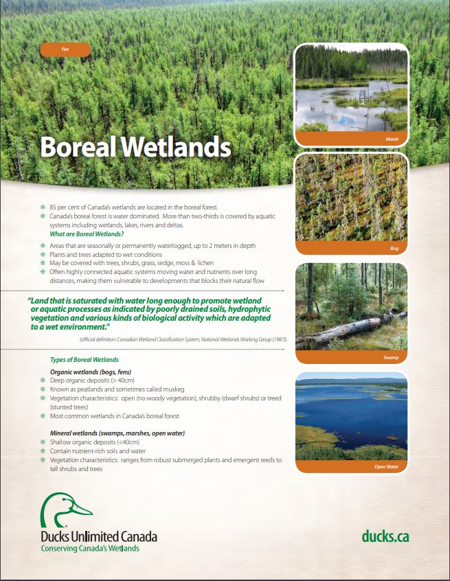
Boreal Wetland Factsheets
Resource
These fact sheets highlight plant, soil, and water indicators and key ecological benefits of each of the five major wetlands types.
Boreal Wetlands and Waterfowl: A Commitment to Stewardship Activities in Manitoba
Resource
Ducks Unlimited Canada (DUC) initiated the Western Boreal Program in 1997 with an understanding that working with forward thinking forest industry partners was key to advancing wetland conservation in...

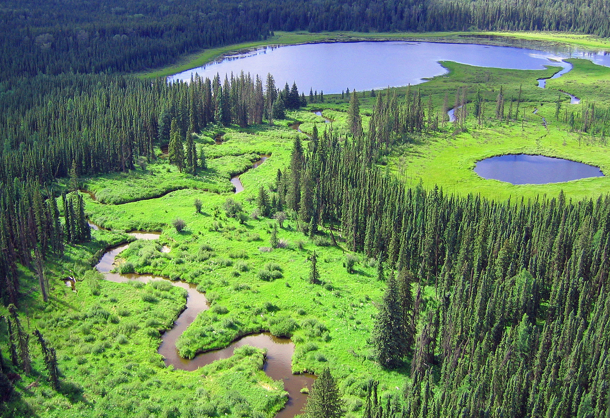
Boreal Wetlands of Canada and the United States of America
Resource
The Canadian and Alaskan boreal zone is one of the most water rich areas in the world, and contains an estimated combined surface water and peatland area the size of Indonesia (∼1.94 million km2)...
Building Better Crossings: Incorporating Wetland Knowledge into Road Planning and Construction
Resource
This research poster gives an overview of the relationship between roads and wetland flow, discusses tips and tools for planning and outlines a case study of developed crossings. Presented at the NAIT...

Canadian Fieldwork Applications
Resource
Did you know that you can learn to identify and report invasive species, measure trees, and become a citizen scientist all at the touch of your smartphone? Check out this list of free, Canadian field...

Canadian Wetland Inventory using Google Earth Engine: The First Map and Preliminary Results
Resource
Although wetlands provide valuable services to humans and the environment and cover a large portion of Canada, there is currently no Canada-wide wetland inventory based on the specifications defined...
