Search Results
Recovery Strategy for Barren-Ground Caribou in the Northwest Territories
Resource

Recovery Strategy for the Boreal Caribou (Rangifer tarandus caribou) in the Northwest Territories
Resource

Relationships between Rangifer and Indigenous Well-being in the North American Arctic and Subarctic: A Review Based on the Academic Published Literature
Resource
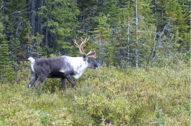
Satellite Collaring Barren Ground Caribou
Resource

Seasonal Patterns in Nutritional Condition of Caribou (Rangifer tarandus) in the Southern Northwest Territories and Northeastern British Columbia, Canada
Resource
Setting a Foundation for Indigenous Knowledge Systems-guided Boreal Caribou (tǫdzı) Conservation Planning in the Western Boreal Region of Canada: A Systematic Map Protocol
Resource

Status of Porcupine Caribou and Barren-ground Caribou in the NWT
Resource

Tactical Departures and Strategic Arrivals: Divergent Effects of Climate and Weather on Caribou Spring Migrations
Resource
“The Caribou Taste Different Now": Inuit Elders Observe Climate Change
Resource
In full colour with photos of the 145 contributing Inuit elders, “The Caribou Taste Different Now” grounds the discussions, debates, and discourses about climate change to material and everyday life in the contemporary Canadian Arctic.

The Direct and Habitat-mediated Influence of Climate on the Biogeography of Boreal Caribou in Canada
Resource
The Impacts of Climate and Social Changes on Cloudberry (Bakeapple) Picking: A Case Study from Southeastern Labrador
Resource

The Multisource Vegetation Inventory (MVI): A Satellite-Based Forest Inventory for the Northwest Territories Taiga Plains
Resource
Wall-to-wall 30 m raster maps of broad forest type, stand height, crown closure, stand volume, total volume, aboveground biomass, and stand age were created for a ~400,000 km2 area, validated with independent data, and generalized into a polygon GIS layer resembling a traditional FI map. The MVI project showed that a reasonably accurate FI map for large, remote, predominantly non-inventoried boreal regions can be obtained at a low cost by combining limited field data with remote sensing data from multiple sources.
The Potential of Carbon Nanoparticles as a Stimulant to Improve the Propagation of Native Boreal Forest Species: A Mini-Review
Resource
The Potential of Rock Dust Nanoparticles to Improve Seed Germination and Seedling Vigor of Native Species: A Review
Resource
The Third Generation of Pan-Canadian Wetland Map at 10 m Resolution Using Multisource Earth Observation Data on Cloud Computing Platform
Resource

“These Trees Have Stories to Tell”: Linking Dënesǫ́łıné Oral History of Caribou Use with Trample Scar Frequency on Black Spruce Roots at Ɂedacho Kué
Resource
Theses - Memorial University of Newfoundland
Project

Trophic Consequences of Terrestrial Eutrophication for a Threatened Ungulate
Resource