
Wetlands Knowledge Search Results
Displaying:
401 - 420 of 2891
Automated Characterization of Forest Canopy Vertical Layering for Predicting Forest Inventory Attributes by Layer Using Airborne LiDAR Data
Resource
Forest canopy vertical layering influences stand development and yield and is critical information for forest management planning and wood supply analysis. It is also relevant for other applications...

Automated Classification of Avian Vocal Activity Using Acoustic Indices in Regional and Heterogeneous Datasets
Resource
Acoustic indices combined with clustering and classification approaches have been increasingly used to automate identification of the presence of vocalizing taxa or acoustic events of interest. While...

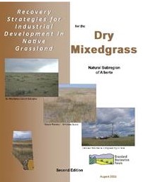
Available for Download: Recovery Strategies for Industrial Development in Native Grassland for the Dry Mixedgrass Natural Subregion 2nd Edition
News
Organization
The Grassland Restoration Forum is proud to present the long-awaited 2nd Edition of the Recovery Strategies for the Dry Mixedgrass Natural Subregion ( download here). In addition to updating the...
Avian Colonization of Reclaimed Areas on the Suncor Lease
Resource
Reclamation activities on the Suncor lease have resulted in the development of a variety of habitat types over the past nineteen years. Many reclamation areas assume a patchy habitat type which...


Balancing Focal Species, Recreation and Biodiversity in Mountain Coal Mine Closure Planning – Alberta, Canada
Resource
Goals: Maintain and enhance focal species habitat and populations; preserve pre-disturbance or modified recreational land use opportunities; and approximate pre-disturbance native biological diversity

Balsam Fir-Yellow Birch Forest Succession in the Lower St. Lawrence Region
Resource
In Quebec, the bioclimatic zone of balsam fir-yellow birch covers an area of 94,768 km 2. Some of the forest cover types in the area, such as balsam fir-yellow birch, are among the most productive in...


Baseline Condition of Jack Pine Biomonitoring Plots in the Athabasca Oil Sands Area, 1976-1977
Resource
No measureable air pollutant effect was observed on either vascular or lichen communities at any site even though significantly high tissue pollutant concentrations were documented within 10km of GCOS

Baseline Environmental Studies of Ruth Lake and Poplar Creek
Resource
Ruth Lake is a small, littoral, moderately eutrophic lake. Poplar Creek is a small, brownwater tributary of the Athabasca River.

Baseline Growth Performance Levels and Assessment Procedure for Commercial Tree Species in Alberta’s Mountains and Foothills
Resource
data were used to define reasonable expectations of early growth performance under prevailing environmental conditions, as a basis for evaluating the success of reforestation following coal mining

Baseline Inventory of Aquatic Macrophyte Species Distributions in the AOSERP Study Area
Resource
Relationship between aquatic macrophyte growth and habitat factors found in the AOSERP study area is outlined, as are some implications of aquatic macrophyte inventory for management and revegetation

Baseline States of Organic Constituents in the Athabasca River System Upstream of Fort McMurray
Resource
Investigations were carried out on the Athabasca River upstream of Fort McMurray to determine the baseline quantities of organic constituents and their contribution to the organic water quality

Baseline Studies of Aquatic Environments in the Athabasca River Near Lease 17
Resource
The study consisted of three parts: 1) A general reconnaissance early in the study period including a survey of fish species, benthic invertebrates, periphyton (attached algae) and water quality

Baseline Study of the Water Quality and Aquatic Resources of the MacKay River, Alberta
Resource
Peak discharge for the year was 22.5 m3/sec and the low 0.2 m3/sec. A total of 80 benthic macroinvertebrate taxa and 19 fish species were collected.
