Wetlands Knowledge Search Results
Resource
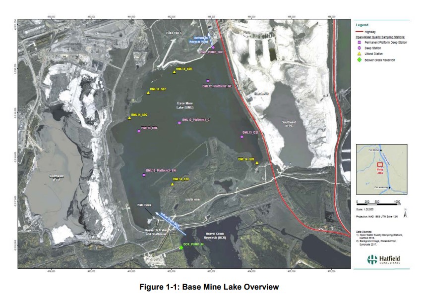
Syncrude's Base Mine Lake (BML) is the first, and currently the only full-scale commercial demonstration of the end pit lake technology in the oil sands industry. An oil sands end pit lake (EPL) is an...
Resource
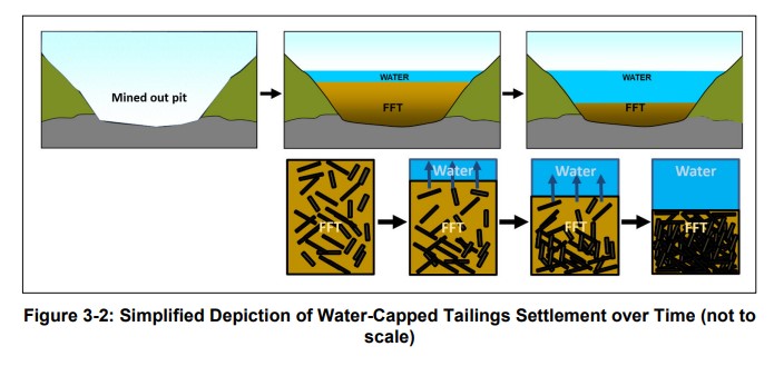
Syncrude first began investigating the Water-Capped Tailings Technology (WCTT) in the early 1980’s through the establishment of a research program founded on progressive scaled-up testing of water...
Resource
Authors
Sean Konkolics
Melanie Dickie
Robert Serrouya
Dave Hervieux
Stan Boutin
Resource Date:
August
2021
This resource is available on an external database and may require a paid subscription to access it. It is included on the CCLM to support our goal of capturing and sharing the breadth of all...
Resource
Authors
Pierre Taillardat
Annika Linkhorst
Charles Deblois
Antonin Prijac
Laure Gandois
Alain Tremblay
Michelle Garneau
Peatlands store organic carbon available for decomposition and transfer to neighboring water bodies, which can ultimately generate carbon dioxide (CO 2) and methane (CH 4) emissions. The objective of...
Resource
Many after-uses of aggregate extraction land do exist: forestry, agriculture, recreation, nature reserves, housing and waste disposal sites. Attempts at reclaiming this land for alternate uses has...
Resource
Authors
Don Russell
Anne Gunn
Robert White
Using the caribou cumulative effects model, an existing decision support tool, we evaluate 6 alternative development scenarios, from no leasing to full leasing with standard mitigation conditions
Resource
This field guide is designed as a stewardship tool primarily for forest harvesters, woodland managers, and private woodland owners working in Nova Scotia.
Resource
Authors
Kevin Smith
Christopher Smith
Silvie Forest
Alain Richard
This guide provides an in-depth look at Ducks Unlimited Canada's (DUC) remote-sensing satellite mapping efforts and the development of the DUC enhanced wetland classification system.
Resource
Authors
Government of the Northwest Territories
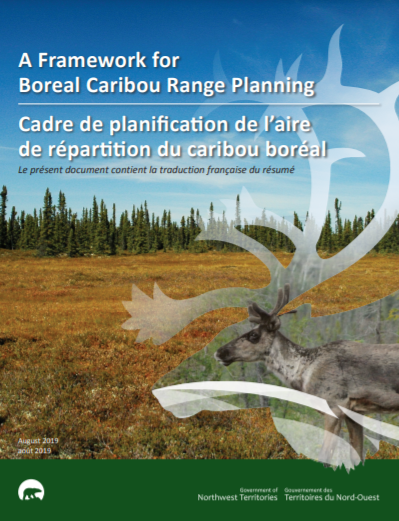
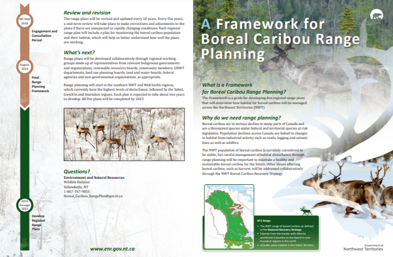
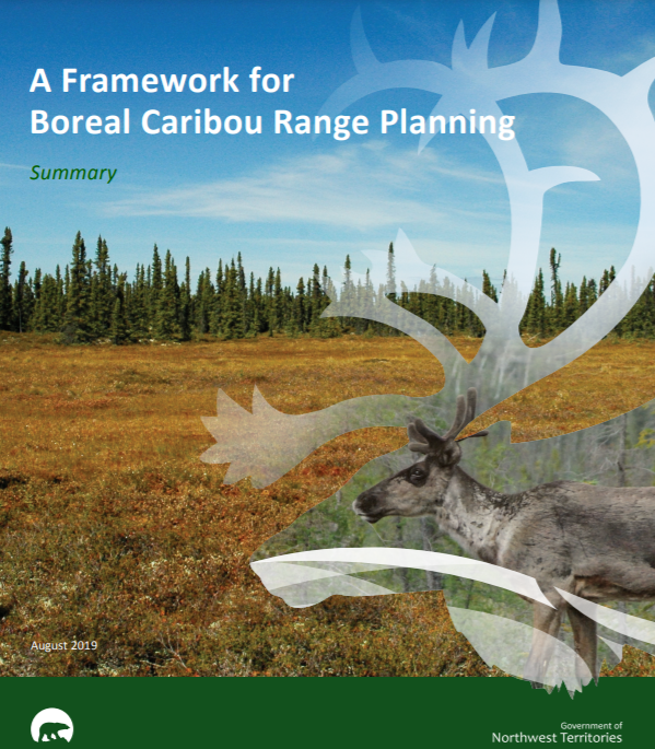
This document outlines an approach to range planning for boreal woodland caribou (hereafter “boreal caribou”) in the Northwest Territories (NWT). It provides a common framework for how individual...
Resource
Authors
Government of Northwest Territories
What is a Framework for Boreal Caribou Range Planning? The Framework is a guide for developing five regional range plans that will determine how habitat for boreal caribou will be managed across the...
Resource
Authors
Government of Northwest Territories
Resource Date:
August
2019
The Framework for Boreal Caribou Range Planning is a guide for developing five regional range plans that will determine how habitat for boreal caribou will be managed across the Northwest Territories...
Resource
Authors
Tracy Lee
Lea Randall
Nicole Kahal
Holly Kinas
Vanessa Carney
Heather Rudd
Tyne Baker
Ken Sanderson
Irena Creed
Axel Moehrenschlager
Danah Duke
Resource Date:
March
2022
Cities worldwide are expanding in area and human population, posing multiple challenges to amphibian populations, including habitat loss from removal of wetlands and terrestrial upland habitat...
Resource
Authors
John Boulanger
Jan Adamczewski
A 39-page academic paper from 2016 designed to help assess the impact of hunting on barren-ground caribou herds, based on the population size and trend of a given herd.
Resource
A team from the ABMI’s Caribou Monitoring Unit, studied links between habitat alteration (e.g., forest harvesting), primary productivity, moose, wolves, and caribou across the Canadian boreal forest
Resource
Authors
Kelly Hokanson
Paul Moore
Max Lukenbach
Kevin Devito
Nicholas Kettridge
Richard Petrone
Carl Mendoza
James Waddington
Resource Date:
January
2018
Northern peatlands are important global carbon stores, but there is concern that these boreal peat reserves are at risk due to increased fire frequency and severity as predicted by climate change...
Resource
Authors
Craig DeMars
John Boulanger
Robert Serrouya
Effective wildlife management requires monitoring changes in the spatial distribution of species, their population size and their population trend (Williams et al. 2002; Sinclair et al. 2006)...
Resource
Authors
Ungava Peninsula Caribou Aboriginal Round Table
The Indigenous Peoples of Ungava self-organized into the Ungava Peninsula Caribou Aboriginal Round Table (“UPCART” or “the Round Table”) in early 2013. For the first time in human history the Peoples...
Resource
Authors
Laura Neary
Casey Remmer
Jadine Krist
Brent Wolfe
Roland Hall
Recent drawdown of the delta’s abundant shallow lakes and rivers has deteriorated vital habitat for wildlife and impaired navigation routes. Here, we report continuous measurements at ~50 lakes during...
Resource
Authors
Mir Mustafizur Rahman
Gregory McDermid
Maria Strack
Julie Lovitt
Resource Date:
October
2017
Groundwater level (GWL) and depth to water (DTW) are related metrics aimed at characterizing groundwater-table positions in peatlands, and two of the most common variables collected by researchers...
Resource
Authors
Nick Salafsky
Robyn Irvine
Judy Boshoven
Jaclyn Lucas
Kent Prior
Jean-François Bisaillon
Becky Graham
Paul Harper
André Laurin
Amanda Lavers
Lalenia Neufeld
Richard Margoluis
Resource Date:
October
2021
There is currently a great deal of work being undertaken to collect, analyze, and synthesize available evidence about the effectiveness of conservation strategies. But substantial challenges still...