Wetlands Knowledge Search Results
Resource
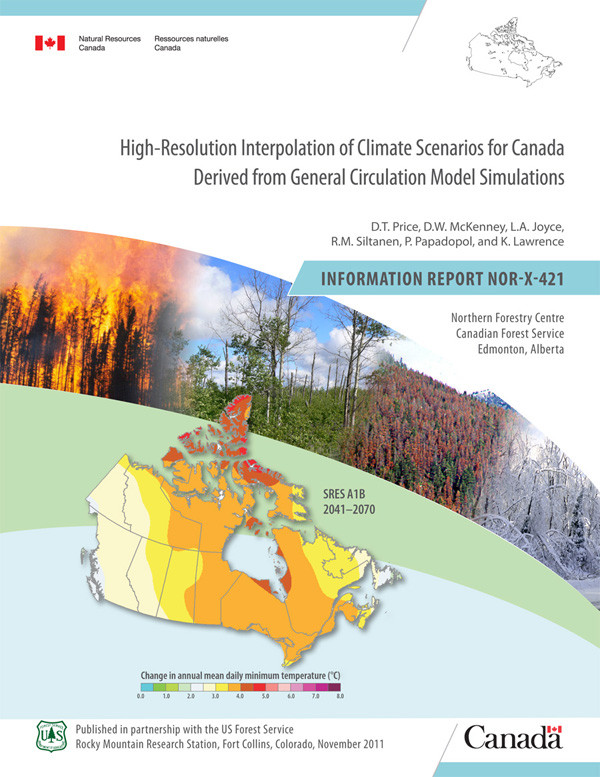
Authors
D.T. Price
D.W. McKenney
L.A. Joyce
R.M. Siltanen
P. Papadopol
K. Lawrence
Projections of future climate were selected for four well-established general circulation models (GCMs) forced by each of three greenhouse gas (GHG) emissions scenarios recommended by the...
Resource
Authors
Jeff Wilson
Scott Heckbert
Craig Aumann
Marius Cutlac
William Donahue
Mike Kennedy
Yongbo Liu
Daiyuan Pan
Wanhong Yang
The model documentation summarizes the data, variables and assumptions required to capture how water purification services are provided across landscapes in Alberta
Resource
Six hundred Douglas-fir (Pseudotsuga menziesii) and 600 lodgepole pine (Pinus contorta var. latifolia) seedlings were planted on seven plots in a cutover north of Golden, British Columbia, to...
Resource
Authors
Charles Bulmer
M.G. Schmidt
B. Kishchuk
C. Preston
We investigated soil factors and tree growth on sites that were clearcut during the 1970s and early 1980s and were subsequently site prepared with either blade scarification (blading) or prescribed...
Resource
Soil conditions, growth of 1200 planted seedlings each of lodgepole pine ( Pinus contorta var. latifolia) and Douglas-fir ( Pseudotsuga menziesii), and development of other vegetation were studied to...
Resource
Authors
Corey Scobie
Alan Marsh
Ryan Fisher
Erin Bayne
Troy Wellicome
Petroleum development has occurred at a rapid pace on the grasslands of Alberta and Saskatchewan. To avoid potential impacts of development on burrowing owls, federal and provincial governments...
Resource
A set of 11 sites were established in the Alberta Oil Sands Environmental Research Program study area to provide baseline information on vegetation and soils with respect to air pollution impact
Resource
Authors
Alberta Environment and Parks
Canada is a party to the UN Convention on Biological Diversity, which identifies the conservation and restoration of biological diversity as a global priority. It is incumbent on the provinces and...
Resource
Authors
Kristi Benson
Janet Winbourne
Boreal caribou are an important animal for First Nations and Métis communities in almost all regions of the NWT. Hunters and Elders have comprehensive traditional knowledge about past and current...
Resource
From 1981 to 1984, nineteen experimental plantations were established on a range of eight typical reforested sectors in seven regions of Quebec. Included in the experiments, which took place during...
Resource
Authors
Doug MacNearney
Karine Pigeon
Laura Finnegan
Resource Date:
October
2016
We used GPS telemetry location data from 63 adult caribou and 6 adult wolves to build spatially explicit resource selection function (RSF) rasters. These RSF rasters describe the within-home-range...
Resource
White spruce ( Picea glauca [Moench] Voss) seedlings were operationally outplanted in May 1993 on a boreal mixedwood site in Biggs Township, Ontario. A factorial randomized block design with four...
Resource
Authors
Mighty Peace Watershed Alliance
The Mighty Peace Watershed Alliance (MPWA) supports the three goals of Alberta’s Water for Life Strategy: safe secure drinking water, healthy aquatic ecosystems, and reliable, quality water supplies...
Resource
Authors
Anne Gunn
Kim Poole
J. Wierzchowski
Brief 2011 report on the use of Thaidene Nene National Park (NWT) by the Ahiak and Bathurst herds. This resource and others can be found on the Northern Caribou Canada website. To find more related...
Resource
Comprehensive assessment of mixing characteristics of the Athabasca River below Fort McMurray under ice-covered flow conditions. Two tracer tests conducted and analysed using recent theoretical models
Resource
Authors
P. Boudewyn
X. Song
S. Magnussen
M.D. Gillis
The demand for forest biomass information has increased substantially in recent years, and, in response, new models have been developed to estimate biomass of forest stands and the more common...
Resource
Potential for using satellite imagery to determine water quality parameters in the southwest end of Lake Athabasca and provide a mathematical model capable of simulating the circulation patterns
Resource
Authors
Ken Foster
Christine Godwin
Peter Pyle
The MAPS protocol (Monitoring Avian Productivity and Survivorship) was applied in a 2011 pilot program in the boreal forest in the oil sands region
Resource
Authors
Nadia Rochdi
J. Zhang
Karl Staenz
X. Yang
D. Rolfson
J. Banting
C. King
R. Doherty
Scope of the project is to develop a geomatics-based monitoring system to support the Government of Alberta’s efforts for monitoring reclamation success. Software will support decision making process
Resource
Eleven plantations of each of jack pine ( Pinus banksiana Lamb.) and black spruce ( Picea mariana [Mill.] B.S.P.) were established with bareroot stock during a 3-year period beginning in 1980 on sites...