
Land Management Search Results
Displaying:
4661 - 4680 of 5539
Use of Anthropogenic Linear Features by Alternative Predators in Woodland Caribou Range
Resource
In this study, we examined seasonal coyote and black bear use of industrial linear features and rivers and streams (i.e. natural linear features). We used two methods to assess movement behavior...

Use of Island and Mainland Shorelines by Woodland Caribou during the Nursery Period in Two Northern Ontario Parks
Resource
Predation is considered a primary limiting factor of woodland caribou ( Rangifer tarandus caribou) populations across North America. Caribou are especially vulnerable to predation during their first...

Use of Linear Features by Mammal Predators and Prey in Managed Boreal Forests
Resource
In managed boreal forests, logging operations maintain high levels of anthropogenic disturbance in the ecosystem. The establishment of permanent anthropogenic linear features such as logging roads in...
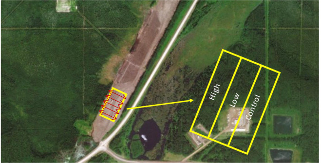
Use of Pulp Mill Biosolids to Stimulate Forest Plant Growth on an Industrial Footprint with Marginal Soil
Resource
Land application of biosolids may be an effective strategy to improve soil quality and better support the establishment of native vegetative cover on an industrial footprint with marginal soil...
Use of Space by Caribou in Northern Canada
Resource
Understanding how populations are structured and how they use natural and anthropogenic spaces is essential for effective wildlife management. A total of 510 barren-ground ( Rangifer tarandus...
Use of the Mating Disruption Approach: Protecting Trees by Tricking Insect Pests
Resource
Controlling insect pests in forests is a constant challenge. Aside from prevention and monitoring, there are very few means available to achieve this goal. With the aim of heading off trouble and...

Use of Three-dimensional Topography as a Tool for Closure Integration at Syncrude Canada Ltd.’s Mildred Lake and Aurora North Leases
Resource
The focus of this paper is the development of a physically sound three-dimensional model of the final closure landscape for the 2011 Life of Mine Closure submission

Use of Unmanned Aerial Vehicles for Monitoring Recovery of Forest Vegetation on Petroleum Well Sites
Resource
Good statistical agreement between key structural vegetation parameters, such as mean and maximum vegetation height, with PPC metrics successfully predicting most height and tree-diameter metrics.

User's Guide Helps Foresters Combat Stem Decay
Resource
The present note is a brief outline of the contents of a user's compendium and guide to stem decay in living trees in Ontario's forests.

Using Aquatic Mesocosms to Assess the Effects of Soil and Vegetation for Informing Environmental Research
Resource
An aquatic mesocosm facility consisting of thirty 15,000 L tanks was constructed in Vegreville, Alberta to support environmental research. In 2017, an experiment was conducted as an inaugural run for...

Using Camera Collars to Study Survival of Migratory Caribou Calves
Resource
This resource is available on an external database and may require a paid subscription to access it. It is included on the CCLM to support our goal of capturing and sharing the breadth of all...
Using camera traps to estimate density and population composition of deer, moose, and elk
Project
Organization:
Aerial surveys are the primary method to assess ungulate population size, demographics, and trends in Alberta. These estimates are used to set hunting license allocations and determine priority areas...
Using causal analysis to advance caribou recovery research and policy
Event
Organization
In this bi-weekly webinar series, audience members from across Canada and diverse organizations join us to explore the latest research and Indigenous ways of knowing regarding caribou ecology and...

Using Genomics to Control Spruce Budworm
Resource
This publication reports on various forest genomics research projects that seek to expand our knowledge of specific spruce budworm (SBW) genes. Canadian Forest Service researchers targeted genes that...

Using GIS and Remote Sensing to Monitor Industrial Impacts to Archaeological Sites in the Athabasca Oil Sands of Alberta
Resource
The Athabasca Oil Sands (AOS) region of Alberta has one of the densest accumulations of known archaeological sites, and possibly the most archaeological sites at risk, in the country. Expanding...

Using Integrated Resource Management and the Public Trust Doctrine to Examine Wildlife Management Practices in Northern Labrador: A Case Study on the George River Caribou Hunting Ban
Resource
A master's thesis that explores the impacts to Labrador Inuit of a hunting ban on the George River Caribou Herd, and how these understanding these impacts can inform better wildlife management in the...
Using Landsat Imagery to Backcast Fire and Post-fire Residuals in the Boreal Shield of Saskatchewan: Implications for Woodland Caribou Management
Project
Contact
Organization:
Project DescriptionMapping of fire from 1988-2013 using the differenced Normalized Burn Ratio analysis of Landsat Thematic mapper and Operational Land Imager. Project Outcomes or Intended OutcomesFor...

Using Landsat Imagery to Backcast Fire and Post-fire Residuals in the Boreal Shield of Saskatchewan: Implications for Woodland Caribou Management
Resource
This resource is available on an external database and may require a paid subscription to access it. It is included on the CCLM to support our goal of capturing and sharing the breadth of all...
Using LiDAR, Colour Infrared Imagery, and Ground Truth Data for Mapping and Characterizing Vegetation Succession on Disturbance Types: Implications for Woodland Caribou (Rangifer tarandus caribou) Habitat Management
Resource
Woodland caribou (Rangifer tarandus caribou) occur throughout Canada’s boreal forest and have been declining both in distribution and population size along the southern extent of their range...