Land Management Search Results
Resource
Dendrochronology study of the relationship between climate and tree growth in the sub-boreal region, an aspatial analysis of habitat suitability for 10 wildlife species, and water stress risk analysis
Resource
Model projections of tree regeneration under climate change on actual oil sands reclamation materials, and comprehensive model analysis of the risks to ecosystem productivity from climate change
Resource
Authors
Peter McLaren
Judith Smith
Overall objectives of this study were to determine the abundance and diversity of terrestrial breeding birds and conduct waterbird inventories to determine what changes, if any, have occurred
Resource
Authors
Oil Sands Research and Information Network
Did You Know series was a means of highlighting interesting current and historical facts about development, economics and environmental management related to the oil sands.
Resource
Authors
Hedwig Lankau
Erin Bayne
Craig Machtans
The boreal forest of western Canada is being dissected by seismic lines used for oil and gas exploration. The vast amount of edge being created is leading to concerns that core habitat will be reduced...
Resource
The area does not appear to include any rare or endangered species and the habitats in the area are common to a large portion of Northern Alberta, therefore area is not critical to any wildlife specie
Resource
Authors
Alberta Biodiversity Monitoring Institute
Caribou Monitoring Unit
To address the issue of increased caribou predation, the ABMI’s Caribou Monitoring Unit (CMU) is currently involved in testing an experimental caribou recovery project, south of Fort McMurray. The CMU...
Resource
Resource Date:
September
2023
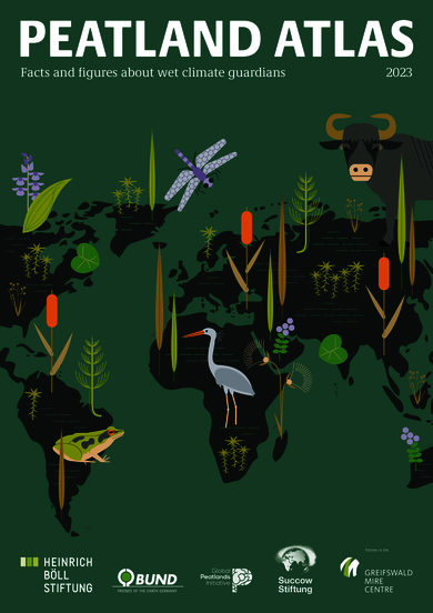
Although peatlands cover only 3% of the world's land, they store about twice as much carbon as in the biomass of all the world's forests combined. Thus, they are incredibly important especially for...
Resource
Authors
Micheline Manseau
Neil Arnason
Sam McFarlane
Paul Wilson
Gigi Pittoello
"A 3-year population monitoring program was put in place for a study area within SK2 Central covering 16,092 km2 using fecal DNA based capture–recapture methods to estimate population sizes and...
Resource
Authors
Brian Eaton
Tyler Muhly
Jason Fisher
Shauna-Lee Chai
Reclaimed mine sites will consist of engineered landforms (including water bodies and waterways); the long-term hydrological and ecological function of those sites may be vulnerable to beaver activity
Resource
Crude average bear density for the AOSERP study area, including water areas, was 0.18 per km2 assuming total avoidance of muskeg areas and 0.25 per km2 assuming use of muskeg
Resource
Authors
L. Cruz-Martinez
Judit Smits
Research on wildlife species, used as either monitors, or indicator species, can provide early warning and predictive information regarding exposure and effects of contaminants from oil sands
Resource
Authors
Matthew Mumma
Michael Gillingham
Katherine Parker
Chris Johnson
Megan Watters
Resource Date:
November
2018
This resource is available on an external database and may require a paid subscription to access it. It is included on the CCLM to support our goal of capturing and sharing the breadth of all...
Resource
Authors
Shauna-Lee Chai
Amy Nixon
Scott Nielsen
Assessed 16 potentially new invasive plant species not yet present in Alberta for their invasiveness and climate change-related risk
Resource
Authors
Jim Schieck
T. Muhly
Dave Huggard
P. Solymos
D. Pan
Scott Heckbert
Erin Bayne
We used information from the Alberta Biodiversity Monitoring Institute (ABMI) on birds, plants, human footprint, and vegetation, plus information from Dr. Bayne on birds, to test a new method for...
Resource
Relative abundance and spatial distribution of moose, deer and 13 species of furbearers were investigated by systematic aerial surveys and winter track counts along 215 km of established transect line
Resource
Authors
A. Brown
M.J. Kent
J.O. Park
R.D. Roberts
3 aspects of aquatic habitat assessment and mapping. 1 - review of the parameters which characterize aquatic habitats. 2 - efficient procedure for collecting the data. 3 - computer mapping techniques
Resource
Authors
Chantel Markle
Paul Moore
Mike Waddington
Identifying ecosystems resilient to climate and land-use changes is recognized as essential for conservation strategies. However, wetland ecosystems may respond differently to stressors depending on...
Resource
Authors
Alberta Biodiversity Monitoring Institute
Boreal caribou populations are declining across Alberta and much of their Canadian range. Key factors causing this decline include a warming climate along with habitat change from industrial...
Resource
Authors
Alberta Biodiversity Monitoring Institute
Seismic lines and other linear features created by humans are thought to negatively impact woodland caribou. It is estimated that there are c. 100,000 km of conventional seismic lines in caribou...