Land Management Search Results
Resource
Authors
Ginny Marshall
Dan Thompson
Kerry Anderson
Brian Simpson
Current methods of predicting fire spread in Canadian forests are suited to large wildfires that spread through natural forests. Recently, the use of mechanical and thinning treatments of forests in...
Resource
Authors
Guillermo Castilla
Ronald Hall
Rob Skakun
Michelle Filiatrault
André Beaudoin
Michael Gartrell
Lisa Smith
Kathleen Groenewegen
Chris Hopkinson
Jurjen van der Sluijs
Resource Date:
February
2022
Wall-to-wall 30 m raster maps of broad forest type, stand height, crown closure, stand volume, total volume, aboveground biomass, and stand age were created for a ~400,000 km2 area, validated with independent data, and generalized into a polygon GIS layer resembling a traditional FI map. The MVI project showed that a reasonably accurate FI map for large, remote, predominantly non-inventoried boreal regions can be obtained at a low cost by combining limited field data with remote sensing data from multiple sources.
Resource
Authors
Teemu Juselius-Rajamäki
Minna Väliranta
Atte Korhola
Resource Date:
October
2023
Peatlands are the most dense terrestrial carbon stock and since the last glacial epoch northern peatlands have accumulated between 400 and 1000 Gt of carbon. Although the horizontal development...
Resource
Authors
Majid Iravani
Monica Kohler
Shannon White
The results showed a pronounced variation in the historic supply of soil organic carbon and aboveground biomass in the watershed. Land management resulted in a diverse range of gains or losses.
Resource
Authors
Dale Vitt
Melissa House
Lilyan Glaeser
Minerogenous peatlands that accumulate deep deposits of organic matter (fens) were an important part of the pre-disturbance landscape across Alberta’s oil sands mining area. Bryophytes occupy 80–100%...
Resource
Authors
Paul Pickell
David Andison
Nicholas Coops
Sarah Gergel
Peter Marshall
Resource development can have significant consequences for the distribution of vegetation cover and for species persistence. Modelling changes to anthropogenic disturbance regimes over time can...
Resource
Authors
Masoud Mahdianpari
Brian Brisco
Jean Granger
Fariba Mohammadimanesh
Bahram Salehi
Saeid Homayouni
Laura Bourgeau-Chavez
Development of the Canadian Wetland Inventory Map (CWIM) has thus far proceeded over two generations, reporting the extent and location of bog, fen, swamp, marsh, and water wetlands across the country...
Resource
Authors
Scott Davidson
Emily Dazé
Eunji Byun
Dean Hiler
Markus Kangur
Julie Talbot
Sarah Finkelstein
Maria Strack
Resource Date:
March
2022
Swamps are a highly significant wetland type in North America both in terms of areal extent and their role in terrestrial carbon cycling. These wetlands, characterized by woody vegetation cover...
Resource
The Alberta Research Council, Inc. (ARC) has conducted a surface coal mine reclamation research program in association with the operations of Smoky River Coal Ltd. near Grande Cache, Alberta since...
Resource
Authors
Cesar Estevo
Diana Stralberg
Scott Nielsen
Erin Bayne
Climate change refugia are areas that are relatively buffered from contemporary climate change and may be important safe havens for wildlife and plants under anthropogenic climate change. Topographic...
Resource
Authors
Karine Pigeon
Meghan Anderson
Doug MacNearney
Jerome Cranston
Gordon Stenhouse
Laura Finnegan
This resource is available on an external database and may require a paid subscription to access it. It is included on the CCLM to support our goal of capturing and sharing the breadth of all...
Resource
Authors
Stephanie Bascu
Christopher Spence
Wetlands that occupy topographic depressions are a defining feature of the Canadian Prairie. These features control hydrological connectivity as they contain high storage capacity relative to...
Resource
Authors
Karine Pigeon
Meghan Anderson
Doug MacNearney
Jerome Cranston
Gordon Stenhouse
Laura Finnegan
This resource is available on an external database and may require a paid subscription to access it. It is included on the CCLM to support our goal of capturing and sharing the breadth of all...
Resource
Recent decline of trembling aspen ( Populus tremuloides Michx.) near St. Walburg, Saskatchewan, prompted a study to document the onset and progress of aspen decline and to examine how past climate...
Resource
Authors
Richard Schneider
Grant Hauer
Vic Adamowicz
Stan Boutin
This resource is available on an external database and may require a paid subscription to access it. It is included on the CCLM to support our goal of capturing and sharing the breadth of all...
Resource
Authors
Terry Macyk
Zdenek Widtman
Vernon Betts
The Alberta Research Council has conducted a surface mine reclamation research program in association with the operations of Smoky River Coal Ltd. near Grande Cache, Alberta since 1972. The main...
Resource
Authors
David Latham
Cecilia Latham
Mark Boyce
Stan Boutin
In this study, we examined seasonal coyote and black bear use of industrial linear features and rivers and streams (i.e. natural linear features). We used two methods to assess movement behavior...
Resource
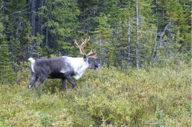
Understanding how populations are structured and how they use natural and anthropogenic spaces is essential for effective wildlife management. A total of 510 barren-ground ( Rangifer tarandus...
Resource
Authors
John Kansas
Javier Vargas
Hans Skatter
Brady Balicki
Kevin McCullum
Resource Date:
March
2016
This resource is available on an external database and may require a paid subscription to access it. It is included on the CCLM to support our goal of capturing and sharing the breadth of all...
Resource
Seismic lines are slow to recover naturally, and many seismic lines need to be restored to contribute towards caribou recovery. Caribou predators use seismic lines to travel throughout caribou ranges...