Land Management Search Results
Resource
Authors
Majid Iravani
Brandon Allen
Ermias Azeria
Monica Kohler
Shannon White
This proof of concept assessment helps understand better market opportunities associated with biodiversity management in Alberta’s agricultural lands. Land management can increase biodiversity.
Resource
Boreal peatlands store approximately one third of the earth’s terrestrial carbon, locked away in currently waterlogged and frozen conditions. Peatlands of boreal and arctic ecosystems are affected...
Resource
Authors
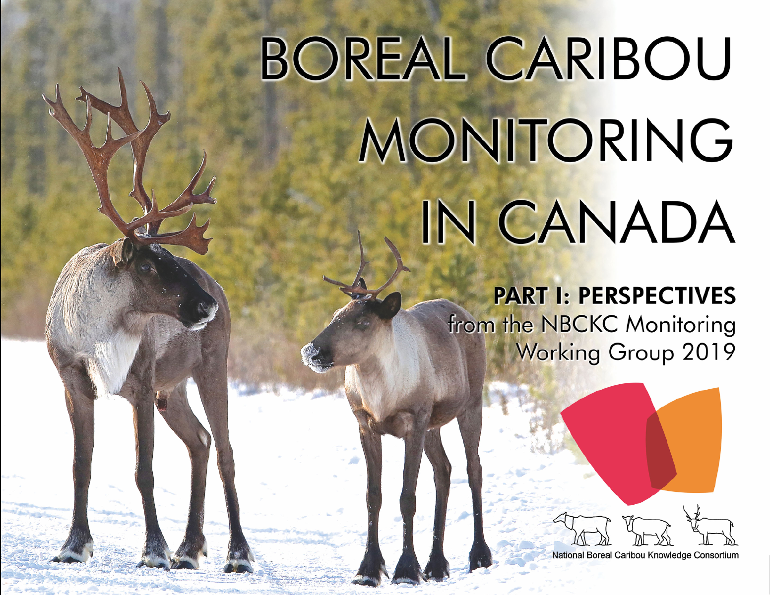
National Boreal Caribou Knowledge Consortium
Monitoring of the Threatened woodland caribou ( Rangifer tarandus caribou ) boreal population (hereafter boreal caribou) presents many challenges, as boreal caribou are broadly distributed in densely...
Resource
In the 70' s a section of the Bow River about 20 km south of Calgary, was diverted to protect a school bus road. A dyke with a 1.5 metre diameter culvert was constructed across the upstream end of the...
Resource
Authors
Christopher Shank
Amy Nixon
This report provides a broad overview of how Alberta species are likely to be affected by climate change by the 2050s. Amphibians were consistently found to be the most vulnerable to climate change
Resource
Forest fire is the primary natural disturbance process influencing the distribution and abundance of terrestrial lichens across ranges of woodland caribou ( Rangifer tarandus caribou), including the...
Resource
Authors
Alex Schumacher
Reinhard Hermesh
Antoine Bedwany
The study involved an examination of the vegetation and spoils on five mine locations in the central Parkland of Alberta. These five locations represented different spoil types, and methods of mining...
Resource
Authors
Alberta Environment and Parks
This code of practice regulates wetland restoration and wetland construction activities as defined in the Code by replacing Water Act approval requirements. Wetland restoration is applied to wetlands...
Resource
Authors
Harald Thimm
G.J. Clark
G. Baker
The construction of a wastewater evaporation lagoon at the Quirk Creek Gas Plant a number of years ago resulted in the creation of a six acre area of overburden consisting of heavy clay, gravel and...
Resource
Authors
Chris Powter
Brent Scorfield
Brent Lakeman
Shane Patterson
The development of integrated geomatics and remote sensing technologies for environmental management holds promise to meet economic diversification and effective environmental management.
Resource
Authors
Bev Gingras
Cynthia Paszkowski
Garry Scrimgeour
Sharon Kendall
Objective was to compare the effectiveness of four commonly used sampling techniques (pitfall traps, funnel traps, visual searches and call surveys) to detect stream amphibian communities.
Resource
Authors
Terry Macyk
Bonnie Drozdowski
This report identifies and summarizes reclamation practices that have been used in the mineable Oil Sands region and coal mining industry over the last 40+ years.
Resource
This paper describes the co-operative participation of the Alberta Government Departments of Forestry, Lands and Wildlife; Recreation and Parks; Environment; the County of Parkland and TransAlta...
Resource
Resource Date:
December
2014
With many boreal caribou population ranges across Canada in non-self sustaining condition, habitat restoration has become an increasing imperative for recovery of this species at risk. With decades...
Resource
Authors
Alberta Biodiversity Monitoring Institute
This report is part of a larger endeavor to develop a monitoring program capable of detecting changes in the biological diversity of Alberta’s forested region.
Resource
Soil quality criteria for Alberta's resource extraction industries were prepared by the Soil Quality Criteria Subcommittee of the Alberta Soils Advisory Committee. The document produced was intended...
Resource
Authors
G.R. Larocque
J. Beaulieu
G. Daoust
C.-H. Ung
There is renewed interest in the management of eastern white pine ( Pinus strobus L.) for high-quality wood production. Several tree improvement programs have been implemented for the last few decades...
Resource
Authors
Sarah Thacker
Sara Venskaitis
Kevin Renkema
Emily Herdman
Earth observation (EO), remote sensing (RS), and other digital technologies are emerging as powerful tools for monitoring the environment and collecting environmental data. These technologies can be...
Resource
Highway rights-of-way in Alberta, and elsewhere, are dull because they consist of limited, non-native species mixes that are frequently mowed. These rights-of-way are therefore not much more exciting...
Resource
Authors
ERMP Project Advisory Group
Monitoring protocols for forested land wellsites to determine if a reclaimed site has returned to similar structure and function as found in a representative undisturbed reference area.