Land Management Search Results
Resource
Authors
Mark Trudell
Stephen Moran
Terry Macyk
This is one of a series of reports that presents the findings of the Plains Hydrology and Reclamation Project (PHRP), an interdisciplinary study that focuses primarily on hydrologic aspects of the...
Resource
Authors
Kirsten Lees
Tristan Quaife
Rebekka Artz
Myroslava Khomik
Joanna Clark
Resource Date:
February
2015
Peatlands store large amounts of terrestrial carbon and any changes to their carbon balance could cause large changes in the greenhouse gas (GHG) balance of the Earth's atmosphere. There is still much...
Resource
Authors
Brian Eaton
Tyler Muhly
Jason Fisher
Shauna-Lee Chai
Reclaimed mine sites will consist of engineered landforms (including water bodies and waterways); the long-term hydrological and ecological function of those sites may be vulnerable to beaver activity
Resource
Resource Date:
December
2021
This Briefing Note presents key information on practical peatland rewetting and restoration on site. It formulates general guiding principles applicable to all peatland restoration practices and...
Resource
Authors
David McNabb
Jean-Marie Sobze
Amanda Schoonmaker
Minimizing the footprint of industrial operation on forest lands is an important goal for maintaining the integrity and sustainability of forest species and communities. Industrial operations and...
Resource
Authors
Shauna-Lee Chai
Amy Nixon
Scott Nielsen
Assessed 16 potentially new invasive plant species not yet present in Alberta for their invasiveness and climate change-related risk
Resource
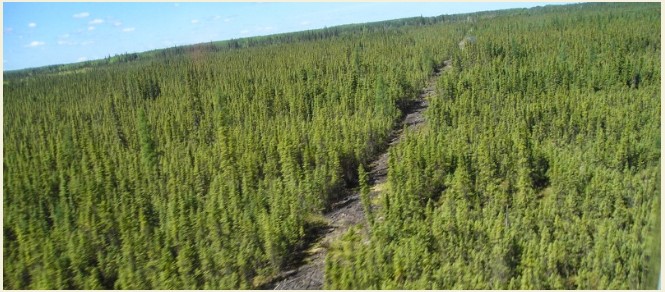
Mapping of oil reserves involves the use of seismic lines (linear disturbances) to determine size of reserves. These linear disturbances fragment forests and in many cases fail to regenerate trees...
Resource
Authors
Bonnie Drozdowski
Craig Aumann
Chris Powter
Report of a seminar to develop a collective understanding of the benefits and opportunities of Predictive Soil Mapping as they relate to Alberta
Resource
Authors
Alberta Health, Environmental Health Services Division
On May 30, 1968 G.C.O.S requested permission to discharge 110 x 106 ft3 of effluent from the sands tailings pond at the Fort McMurray site into the Athabasca River during periods of high river flow
Resource
Modelling results for the regional watersheds were encouraging and demonstrate that SWATBF has the potential to be utilized as a practical tool for conducting hydrologic assessments in the oil sands
Resource
Authors
Heather Tokay
Kevin Renkema
Dean MacKenzie
Chris Powter
Bonnie Drozdowski
Natalie Shelby-James
In 2021, PTAC sought verification of the Guide to Preparing Variance Justifications and stakeholders were asked to apply the document to current sites in their work portfolio.
Resource
Because of the considerable area of peatlands in Alberta, the increasing uses of peatlands for various purposes, and the potential impacts of pollutants, there is concern about the effects on the qual
News
Pulse Seismic Inc. (Pulse) and the Alberta Biodiversity Monitoring Institute (ABMI) have signed a data sharing agreement to enhance public information on seismic lines in Alberta.
Resource
Authors
Chantel Markle
Paul Moore
Mike Waddington
Identifying ecosystems resilient to climate and land-use changes is recognized as essential for conservation strategies. However, wetland ecosystems may respond differently to stressors depending on...
Resource
Authors
NAIT Centre for Boreal Research
Vegetation management is critical to establishing desirable plant species and to achieving reclamation objectives. This resource is one of four technical notes on vegetation management for reclamation...
Resource
Authors
NAIT Centre for Boreal Research
Vegetation management is critical to establishing desirable plant species and to achieving reclamation objectives. This resource is one of four technical notes on vegetation management for reclamation...
Resource
Upland mesic sites showed a relatively strong ability to regenerate on their own (passive restoration), while lowland (bogs and fens) and upland dry sites were slow to recover.
Resource
Authors
Alberta Biodiversity Monitoring Institute
Boreal caribou populations are declining across Alberta and much of their Canadian range. Key factors causing this decline include a warming climate along with habitat change from industrial...
Resource
Authors
Alberta Biodiversity Monitoring Institute
Seismic lines and other linear features created by humans are thought to negatively impact woodland caribou. It is estimated that there are c. 100,000 km of conventional seismic lines in caribou...
Resource
Authors
Alberta Biodiversity Monitoring Institute
Resource Date:
January
2020
Linear features, including seismic lines, pipelines, transmission lines, roads, railways, and trails are pervasive in Alberta’s boreal forest and have been implicated as a primary factor leading to...