Land Management Search Results
Resource
Authors
Alberta Biodiversity Monitoring Institute
Caribou Monitoring Unit
To address the issue of increased caribou predation, the ABMI’s Caribou Monitoring Unit (CMU) is currently involved in testing an experimental caribou recovery project, south of Fort McMurray. The CMU...
Resource
Passive biological treatments have been proposed as a possible efficient and cost effective treatment method for metal bearing water discharged from mine sites after closure. Several biofilters are...
Resource
Authors
Tracy Davison
Judy Williams
A 21-page 2016 report on a 2012 aerial survey of Peary caribou and muskoxen on several Arctic islands shared by the NWT and Nunavut. This resource and others can be found on the Northern Caribou...
Resource
Resource Date:
September
2023
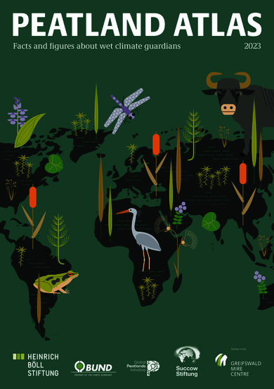
Although peatlands cover only 3% of the world's land, they store about twice as much carbon as in the biomass of all the world's forests combined. Thus, they are incredibly important especially for...
Resource
Authors
G.R. Hillman
J.D. Johnson
Sam Takyi
Three experimental forest drainage sites were established in Alberta’s boreal forest to determine the effects of lowered water tables on soils, local hydrology, ground vegetation composition and tree...
Resource
Authors
B. Ayres
Mike O'Kane
Lee Barber
D. Hiller
D. Helps
The Claude waste rock pile at Cluff Lake uranium mine in northern Saskatchewan's Athabasca basin contains ~7.2 million tonnes of waste rock, upon which an engineered enhanced store-and-release cover...
Resource
Authors
Stephen Moran
Terry Macyk
Mark Trudell
Margot Pigot
In 1985, a one hectare pond developed in the upland reclaimed landscape at Vesta Mine in an area where extensive ponding had not previously been observed. Because of the thickness of the spoil, about...
Resource
Physical changes evident at tributary confluences were Secchi visibility, current velocity, and flow direction. At the tributary mouths, sand and silt substrates were predominant in sheltered areas
Resource
Vezza Mine, a former gold mine includes a three-compartment shaft with four underground levels down to a depth of 741 metres, This mine was never put in production since its construction around 1997...
Resource
Authors
Stephen Moran
Mark Trudell
Terry Macyk
Daphne Cheel
The first phase of the study, which was completed in 1984, included characterization and instrumentation of two study areas: the Battle River study area, which included Diplomat, Vesta and Paintearth...
Resource
Authors
Philip McLoughlin
Clara Superbie
Kathrine Stewart
Patricia Tomchuk
Branden Neufeld
Dale Barks
Tom Perry
Ruth Greuel
Charlotte Regan
Alexandre Truchon-Savard
Sarah Hart
Jonathan Henkelman
Jill Johnstone
Research completed by the University of Saskatchewan in collaboration with a consortium of industry and government partners. Research included a multi-faceted program on the population dynamics and...
Resource
Authors
Micheline Manseau
Neil Arnason
Sam McFarlane
Paul Wilson
Gigi Pittoello
"A 3-year population monitoring program was put in place for a study area within SK2 Central covering 16,092 km2 using fecal DNA based capture–recapture methods to estimate population sizes and...
Resource
Authors
Mark Trudell
Stephen Moran
Terry Macyk
This is one of a series of reports that presents the findings of the Plains Hydrology and Reclamation Project (PHRP), an interdisciplinary study that focuses primarily on hydrologic aspects of the...
Resource
Authors
Brian Eaton
Tyler Muhly
Jason Fisher
Shauna-Lee Chai
Reclaimed mine sites will consist of engineered landforms (including water bodies and waterways); the long-term hydrological and ecological function of those sites may be vulnerable to beaver activity
Resource
Crude average bear density for the AOSERP study area, including water areas, was 0.18 per km2 assuming total avoidance of muskeg areas and 0.25 per km2 assuming use of muskeg
Resource
Authors
L. Cruz-Martinez
Judit Smits
Research on wildlife species, used as either monitors, or indicator species, can provide early warning and predictive information regarding exposure and effects of contaminants from oil sands
Resource
Authors
Shauna-Lee Chai
Amy Nixon
Scott Nielsen
Assessed 16 potentially new invasive plant species not yet present in Alberta for their invasiveness and climate change-related risk
Resource
Authors
Jim Schieck
T. Muhly
Dave Huggard
P. Solymos
D. Pan
Scott Heckbert
Erin Bayne
We used information from the Alberta Biodiversity Monitoring Institute (ABMI) on birds, plants, human footprint, and vegetation, plus information from Dr. Bayne on birds, to test a new method for...
Resource
Relative abundance and spatial distribution of moose, deer and 13 species of furbearers were investigated by systematic aerial surveys and winter track counts along 215 km of established transect line
Resource
Authors
Alberta Health, Environmental Health Services Division
On May 30, 1968 G.C.O.S requested permission to discharge 110 x 106 ft3 of effluent from the sands tailings pond at the Fort McMurray site into the Athabasca River during periods of high river flow