Land Management Search Results
Resource
Summary of a survey to determine the reclamation research needs of organizations/industries in Alberta that are involved with industrial disturbances and to prioritize research needs.
Resource
ALCES models future changes based on known environment and landscape cover, an understanding of historic changes, and projected indicators of change to the environment, human footprint and landscape.
Resource
Sahtú Environmental Research and Monitoring (ERM) Forum meeting presentation of the Sahtu Regional Environmental Decision Support Tool Set.
Resource
To assess climatic and soil conditions under which salts will move out of the root zone in a soil disturbed by a pipeline and to determine the rate at which salts will move in disturbed soils.
Resource
Authors
Surya Acharya
Barbara Darroch
Reinhard Hermesh
Jay Woosaree
Alpine bluegrass [Poa alpina L.] and slender wheatgrass [Elymus trachycaulus (Link.) Gould ex Shinners] accessions from alpine and subalpine regions of the Canadian Rocky Mountains and eastern...
Resource
This publication is intended to be a source for plant identification and seed collection and is available to all who wish to use it. We aimed to make the information in this guide illustrative for...
Resource
Authors
Anna Dabros
Matthew Pyper
Guillermo Castilla
Resource Date:
February
2018
The oil and gas industry has grown significantly throughout the boreal and arctic ecosystems of North America. A major feature of the ecological footprint of oil and gas exploration is seismic lines...
Resource
Authors
Patrick Deane
Sophie Wilkinson
Paul Moore
James Waddington
Across the Boreal, there is an expansive wildland–society interface (WSI), where communities, infrastructure, and industry border natural ecosystems, exposing them to the impacts of natural...
Resource
One of the major tasks facing the coal mining industry today is dealing with environmental concerns. The requirement of selectively handling topsoil and subsoil for reclaiming plains strip mines is...
Resource
Authors
Chris Powter
John Hogenbirk
If you are planning or undertaking revegetation using long-lived species such as trees then you should be giving some consideration to the environment they may experience in the future
Resource
Authors
Laura Chasmer
Edberto Moura Lima
Craig Mahoney
Chris Hopkinson
Joshua Montgomery
Danielle Cobbaert
Resource Date:
August
2021
Bi-temporal LiDAR data used to identify correspondence between density of anthropogenic disturbances, wetland shape complexity and changes in vegetation height within >1800 wetlands near Fort McKay
Resource
Authors
Caitlyn Lyons
Brain Branfireun
Jim McLaughlin
Zoë Lindo
This resource is available on an external database and may require a paid subscription to access it. It is included on the CCLM to support our goal of capturing and sharing the breadth of all...
Resource
Authors
Karen Cannon
Sandra Landsburg
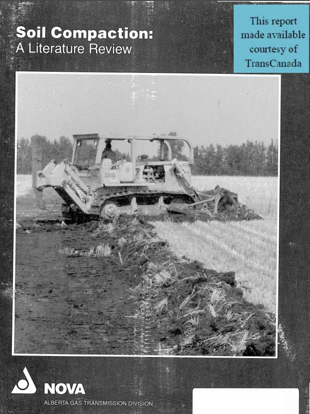
Concerns about soil compaction on pipeline rights-of-way have increased with the introduction of heavier, more powerful construction equipment
Resource
The soil resources in the Highvale Mine area are predominantly thin Black Solodized Solonetzic and Gleysolic soils developed on residual bedrock of the Edmonton Formation. A significant amount of Gray...
Resource
Origins, extent and reclamation of saline soils in Alberta are described. Natural and man-induced salinity are addressed but the latter is emphasized. Major activities/structures responsible for...
Resource
Authors
Pedocan Land Evaluation Ltd.
Part 1 of this manual is a background and explanatory section that describes the terminology used in soil surveys and presents the assumptions and conventions upon which the interpretations are based
Resource
Authors
Pedocan Land Evaluation Ltd.
Part 2 presents typical data and interpretations for each soil series in Alberta. The interpretations were made by applying the guidelines in Part 1, and checking the results against experience
Resource
Authors
Steven Wilson
Glenn Sutherland
Nicholas Larter
Allicia Kelly
Ashley McLaren
James Hodson
Troy Hegel
Robin Steenweg
Dave Hervieux
Thomas Nudds
Understanding spatial distributions of organisms and the consequences for conservation policy and management decisions remain important challenges. We describe a method for grouping caribou into plausible candidate Local Population Units that may better approximate geographic closure than the existing LPUs.
Resource
Visit the species profile for Woodland Caribou (Boreal population) on the Government of Canada Species at Risk Registry HERE
Resource
Authors
InnoTech Alberta
University of Alberta
The InnoTech/UofA above ground mesocosm facility enables configurable, innovative approaches for assessing potential environmental and ecological impacts of industrial activities