Boreal Caribou Search Results
Resource
Authors
D. Meidinger
K.A. Baldwin
The Canadian National Vegetation Classification (CNVC) is an ecological classification of natural and semi-natural Canadian vegetation. The classification is a hierarchical taxonomy, describing...
Resource
Authors
Tegan Holmes
Tricia Stadnyk
Masoud Asadzadeh
John Gibson
This study evaluates whether combined use of streamflow and isotope tracer performance metrics can improve representation of simulated streamflow-generating processes within a large river basin, the...
Resource
Authors
Aino Korrensalo
Tomáš Hájek
Timo Vesala
Lauri Mehtätalo
Eeva-Stiina Tuittila
Resource Date:
November
2016
Plant functional types (PFTs) are used to make generalizations in modeling how plants impact ecosystem functioning. In boreal bogs the number of plant species is small, but several PFTs are...
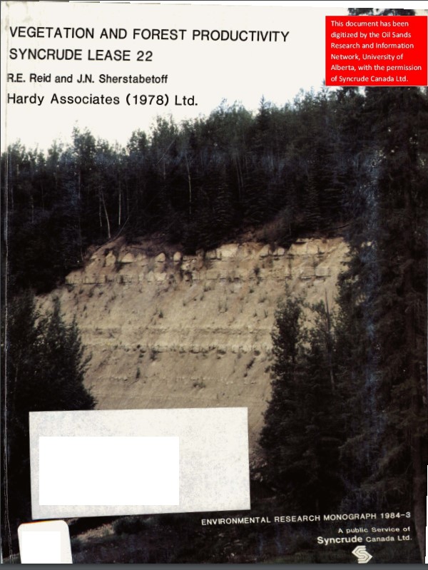
Resource
Authors
Dave Reid
Jim Sherstabetoff
Eleven major vegetation types were identified and are mapped at a scale of 1:20 000 on the eastern portion of Syncrude Lease 17.
Resource
Mountain valley bottom peatlands are poorly studied systems, particularly in Alberta, Canada, where the provincial inventory has neither mapped nor characterized them. Nonetheless, these ecosystems...
Resource
Seismic lines are slow to recover naturally, and many seismic lines need to be restored to contribute towards caribou recovery. Caribou predators use seismic lines to travel throughout caribou ranges...
Resource
This guidebook explains vegetation management tools and techniques. Natural Resources Canada Canadian Forest Service (NRCan-CFS) developed this guidebook to help with the successional restoration of...
Resource
Authors
John Kansas
Micheal Charlebois
Hans Skatter
Low-Impact Seismic (LIS) exploration techniques are being increasingly used in northeastern Alberta, Canada to explore for in-situ oil sands deposits. These narrow (2-4-m wide), meandering man-made...
Resource
Review of provides basis for evaluating the current progress regarding vegetation descriptions in this area and for designing certain future vegetation studies.
Resource
Authors
Everett Peterson
Allan Levinsohn
Black Spruce - Labrador Tea was the dominant vegetation type, making up 35.0% of the 9,250 ha study area. The 2nd most abundant type was Aspen - White Spruce (26.0%) and the 3rd was White Spruce – Asp
Resource
Authors
K.A. Baldwin
Lorna Allen
S. Basquill
K. Chapman
D. Downing
N. Flynn
W. Mackenzie
M. Major
W.J. Meades
D. Meidinger
C. Morneau
J.-P. Saucier
J. Thorpe
Vegetation Zones of Canada: a Biogeoclimatic Perspective maps Canadian geography in relation to regional climate, as indicated by vegetation patterns. Compared to previous similar national-scale...
Resource
Field data on the abundance (or percent cover) of vascular plants, bryophytes, and soil mesofauna were obtained in the summer of 2008 and 2009 from nine produced water release sites in Alberta and...
Resource
Resource Date:
November
2020
The Vermillion River watershed region, found in central Alberta between Edmonton and Lloydminster, is home to residents and farmers who rely on the watershed for drinking water, agriculture, and...
Resource
Technology Transfer Notes are a new series of publications focusing on forestry research applications. Technology Transfer Notes offer new techniques, methods, tools and procedures, and deliver...
Resource
Authors
Jack Mercer
Robert Charlton
Imagery from both meteorological and environmental satellite sensor systems was analyzed to determine its applicability in monitoring weather conditions at the Alberta oil sands.
Resource
Resource Date:
January
2016
With over 75 years of experience and activity in every province and territory, Ducks Unlimited Canada (DUC) is a registered charity and a recognized leader in wetland conservation. DUC is a science...
Resource
Authors
Marc Mayhew
Amanda Schoonmaker
Allan Pollock
This presentation discusses a comparison of site preparation methods on sub-surface soil resistance and moisture on reclaimed industrial sites in northwestern Alberta.
Resource
Donnie McPhee presents a lecture to the Canadian Institute of Forestry on seed research and seed selection for the 2 Billion Trees Program.
Resource
Dr. Richard McCleary draws the links between what we see in the field to the maps we have for planning and points out that the information we need for watershed assessment and riparian zones is the same.
Resource
This presentation describes a method of assessing cumulative effects, taking into account the many drivers or pressures on the landscape and their effects on watershed processes.